
DOWNLOAD THE APP


Customer Services
Copyright © 2025 Desertcart Holdings Limited
DOWNLOAD THE APP
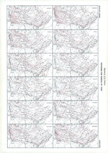
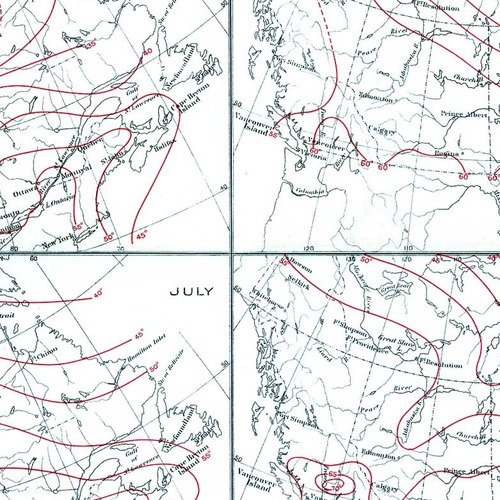
17.25 x 24.25 inches. Printed on matte plastic (Polypropylene). Please note this map is NOT laminated - the page is not appropriate for dry-erase markers. Flat map, tubed for shipping.Contained within the 1st Edition (1906) of the Atlas of Canada is a plate that shows isothermal lines for each month of the year. Within the plate there are 12 maps, one for each month that varies from January to December. These lines are drawn at intervals of 5 degrees Fahrenheit connect the points having the same mean temperature. They are deduced from observations by the Meteorological Service extending over a series of years.
Trustpilot
3 weeks ago
1 week ago
3 weeks ago
1 month ago