We remain fully operational. Our teams are working around the clock to ensure your deliveries continue safely.

DOWNLOAD THE APP


Customer Services
Copyright © 2025 Desertcart Holdings Limited
DOWNLOAD THE APP

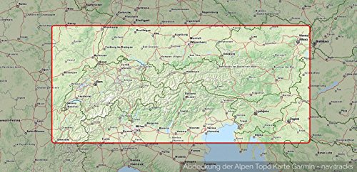
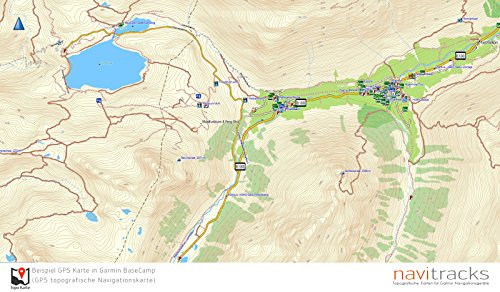
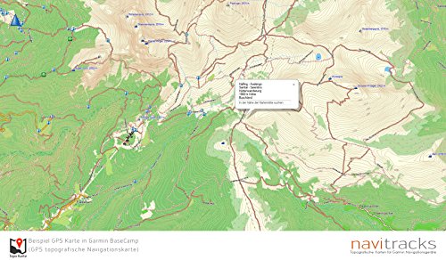
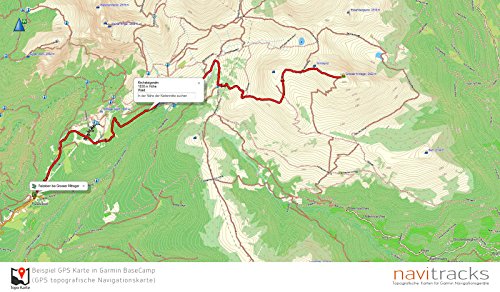
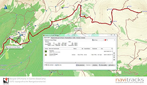
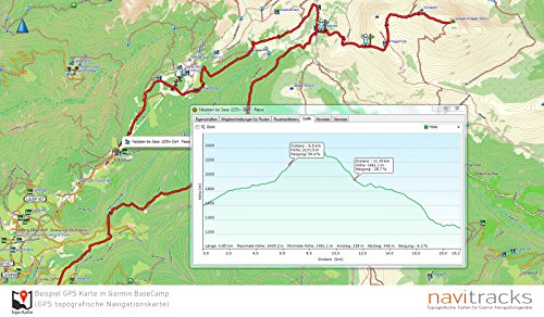
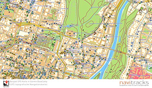
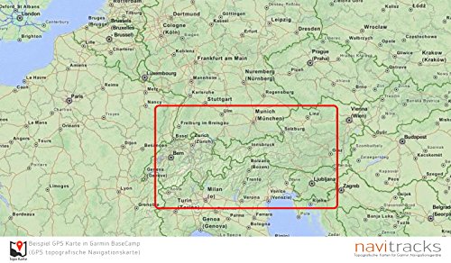
Alpine routing enabled GPS Chart for Garmin Sat Navs. With installation card for Windows and Mac.The GPS card is delivered on a 4GB Micro SD Memory Card With SD card adapter. Height line on the map in a 10 m distance.Topografische the Vector map of Navitracks is included in the base 1: 25,000 map on the microSD memory card. So this card is ideal for navigation and touring planning with a Garmin GPS device. Furthermore, the card can also be used as a Installierbare file for PC and Mac. On the microSD card have been thousands of road mileage as well as height) lines.- Abbi Suitable voice of street name InweiseAddress Search- durchsuchbare pois- Plug & Play CompatibleThe card, with its modern vector technology always got a good overview at maximum density high detail. Allows the individual elements, such as buildings, apparent until when time out. Click on the various parts allows additional information such as name of furnishings, Type of shop, information on roads and paths in be retrieved. The card contains Street Name, rivers, lakes, hill, field paths, path, striking points, points of interest, public services, railway stations, train lines, airports, petrol station, restaurants, hotels, campsites, etc.- Route Planning on the PC and Mac (with Garmin Basecamp)- Transmission of the cards and routes on your PC and Mac on the navigation system- Editing materials routes to adjust the individualCard Material is very detailed and flächendeckend- Supports routingCard is plug & play compatible with all Garmin Satellite Navigation devices with a micro SD card slot (Min) and A4-80 Stainless Steel Screw Material. 4 GB). The card also contains the installation files for PC and Mac. This means you will be able to install the card to your computer for travel plans or for the transfer of cards on older devices.
Trustpilot
3 weeks ago
4 days ago