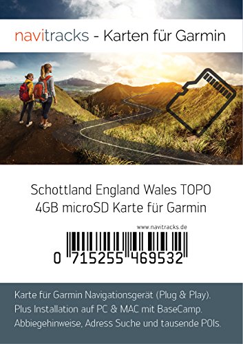
Description
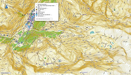
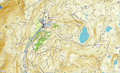
- Scotland Garmin Topographic Map The topographic GPS map is delivered on 4GB microSD card with SD card adapter. Contour lines on the map are available at a distance of 20m. The topographic vector map by Navitracks has a base scale of 1: 25,000 on the Micro SD card. Therefore this map is ideal for navigation and ride planning with a Garmin GPS device. The card can also be installed as a file for PC and Mac computers.
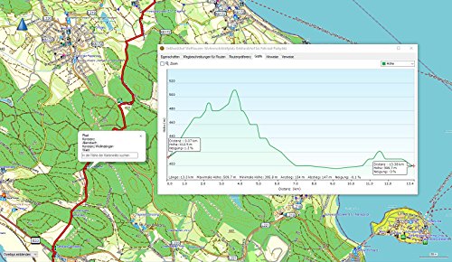
- Route planning on PC and Mac (with the free Garmin software BaseCamp). Transfer of maps and routes from PC and Mac to the Navigation System. Editing of finished routes for individual customisation. The map material is very detailed, comprehensive and always up to date. Supports routing for car, motorcycle and cyclists. Also supports routing for hiking. Map is a suitable elevation model. (Displays the altitude metres on the route in the planning of Garmin BaseCamp.)
- Box Contents: digital topographic recreational map for Garmin-Navi satellite navigation on microSD card with SD card adapter. With a number of POIs (points of interest) and additional map material for the planning software on PC and Mac. Printed instruction leaflet and licensed conditions in digital form. Suitable for: Hiking, Cycling, Mountain Biking or for street navigation.
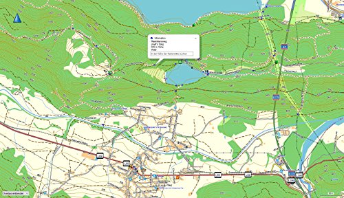
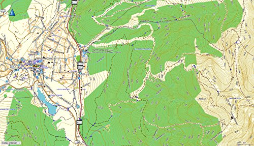
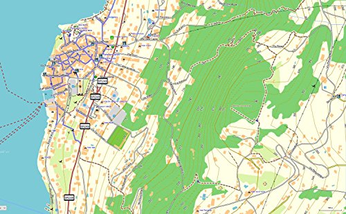
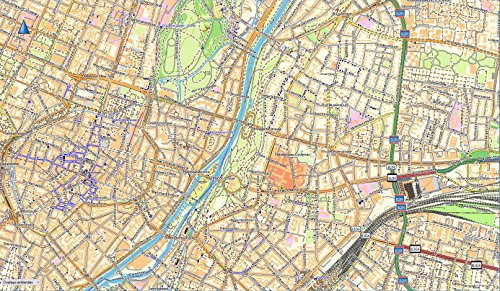
- Thousands of kilometres of road and contour lines are stored on the MicroSD card. The card always offers an optimum overview at maximum detail density. Therefore individual elements such as buildings are first visible by zooming. Clicking on the various individual elements allows additional information such as name of establishment, type of business, information on roads and directions to be retrieved. Turn-by-turn instructions with announcement of street name. Address Search Searchable POIs Plug & Play-compatible
- Map is compatible with Garmin: Camper* Colorado 300 400c 400i 400t dezl 560 570 760 770 dezl Cam Edge 605 705 800 810 1000 Touring Touring Plus Dakota* eTrex 10 20 30, eTrex Touch 25 35 etrex Legend/Vista HCx GPSMap 62-Serie GPSMap 64 64s 64st 78 78s 78sc Oregon 200 300 400 400t 450 450t 500 500t 550 550t 600 600t 650 650t Montana* Monterra* RINO 520HCx 530HCx 650 655t Nüvi*StreetPilot c510 c530 c550 c580 2820 7200 Zümo 210, 220 340 390 400 450 500 550 590 600 660 665 (*All Models.)
Routing capable GPS map for Garmin navigation devices With installation card for Windows and Mac.The GPS map is delivered on 4GB microSD card with SD card adapter. Contour lines on the map are available at a distance of 20m. The topographic vector map by Navitracks has a base scale of 1: 25,000 on the Micro SD card. Therefore this map is ideal for navigation and ride planning with a Garmin GPS device. The map can also be installed as a file for PC and Mac. Thousands of kilometres of road and contour lines are stored on the MicroSD card. - Turn-by-turn instructions with announcement of street name- Address Search- Searchable POIs- Plug & Play-compatibleThe map always offers an optimum overview at maximum detail density. Therefore individual elements such as buildings are first visible by zooming. Clicking on the various individual elements allows additional information such as name of establishment, type of business, information on roads and directions to be retrieved. The map contains street names, rivers, lakes, hills, field paths, paths, marked points, points of interest, public establishments, railway stations, train lines, airports, petrol stations, restaurants, hotels, camp sites, etc.Route planning on PC and Mac (with the free Garmin software BaseCamp)- Transfer of maps and routes from PC and Mac to the Navigation System- Editing of finished routes for individual customisation- Map material is very detailed and comprehensive- Supports routingMap is Plug & Play compatible with all Garmin satellite navigation devices with a microSD card slot (min. 4GB). The map also contains the installation files for PC and Mac. This means you will be able to install the maps to your computer for travel planning or for the transffering maps to older devices.