National Geographic Maps 2.0
Product ID: 132232106
Desertcart purchases this item on your behalf and handles shipping, customs, and support to Australia.
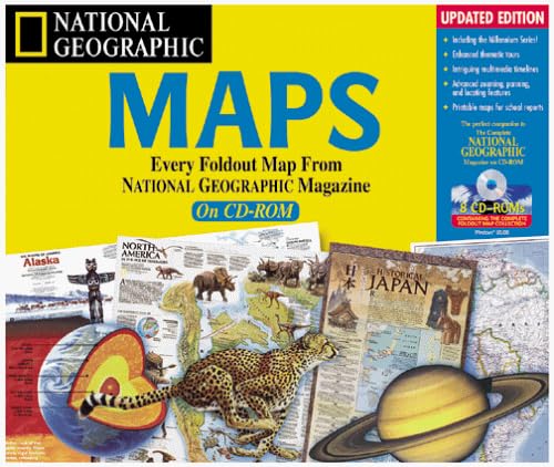
.com National Geographic Maps 2.0 takes every map from the pages of National Geographic Magazine from the last 109 years and brings them together in CD-ROM form. These maps span the complete geography and history of the world, integrating the two through interactive time lines. Pictures, sound, and video clips accompany many of the maps. Program features allow you to zoom and pan on maps for a macro- or microview. You can easily locate an exact point on the map with the map navigator--much faster than trying to use an atlas. Search for maps by key word, geographic location, or theme. Another bonus: you can copy, paste, and print maps directly into your reports and presentations. Review Every foldout map ever printed in National Geographic Magazine can be seen in this eight-CD set. Although the maps are beautiful, they are not as functional as those contained in Encarta Interactive World Atlas 2000. Still, this collection provides a fascinating look at the history and geography of our world, and the nine multimedia map tours of various themes like Peoples of the Past and Space are very interesting. This second version is enhanced with more advanced zooming, panning and locating features. Disk swapping among the eight CDs continues to be a nuisance.Teaches: geography, reference, maps Age Range: 12-up Copyright © 2000 Children's Software Revue -- From Children's Software Revue® -- "Subscribe Now!"
K**V
Unethical seller
Runs on windows 98. This would have been a handy fact to know. To sell this without mentioning this was unethical. I figured it might not work and for $5 it was worth a shot.Unless you have a 20 year old computer don’t even think about it.
T**M
Geography at its best: you don't even have to refold the map
Say the word 'map' and most people's eyes glaze over instantaneously. When over 50% of entering freshmen at American universities claimed in 1990 that Mexico was *north* of the United States, educators across the country got extremely worried. National Geographic started lending a hand to secondary educators in an effort to promote basic geographic understanding.Of course, they'd already been doing something like that for years with their bi-monthly series of map inserts. National Geographic 'maps' have always been much more than a grid on the planet's surface. They've shown the impact of geography on societal development. Indeed, each map generally tied in with an article in that issue, and showed the impact of geography on whatever the theme of that article was. Maybe it would be the development of shipbuilding in Polynesia or the influence of the Church in Europe.This package of excellent software goes the printed map series one better by virtue of its medium. You have complete control over the maps in a way not possible with their print counterparts. Plus, there are a ton of multimedia extras which make the maps come alive. The ability to go anywhere in the world and study not only its present, physical and political geography, but to also see its historical and cultural development, is wholly addictive. I challenge anyone to start using this product and NOT walk away from it enlightened.For those shopping for the best geographical education software, it's worth mentioning that this product compares favorably to _Microsoft Encarta_. Unlike the more thematic offering here, _Encarta_ is a kind of multimedia almanac. It does not pretend to be an exhaustive collection of 100-odd years of cartographic understanding, but rather uses a map interface to frame encyclopediac information. It also allows you to 'corkboard' internet sites about the various geographic regions to the map interface. And it only has one disk, so you don't have to keep flipping back and forth. As such, it's a good, basic, workhorse software for learning about the present nature of the world._National Geographic Maps_, by contrast, makes the world come alive by providing better maps and helping you remember the geographic content by overlaying some kind of theme.As such, _NGM_ is a better educational tool, and _Encarta_ is a more convenient simple reference tool. To be sure, the maps are better on _NGM_, but because of the number of CDs and _Encarta's_ better statistical analysis interface, _Encarta's_ more convenient for quick reference.Still, almost anyone would benefit from introducing _NGM_ to their software library. It's quite simply some of the most valuable time you could spend at your computer. I have only one hesitation about this product: it would be soooo much better on DVD. Flipping through CDs is sometimes laborious, especially if you're trying to follow one theme throughout several different geographic regions. Having it all, or mostly, on one disc would be a massive improvement to the product.
B**T
A wonderful Geographic resource
This collection, spanning the entire National Geographic Society's history, is a wonderfuly tool. Each and every map ever printed by the Society is here in perfect digital clarity. Though an excellent companion to their Complete National Geographic software, this product is great stand alone as well.National Geographic maps have long been invaluable resources to virtually everyone (Byrd carried one over the North Pole in '26, extensively utilized by the allies in WWII, etc.) and this software collects them all! While not as wholly geographically informative as a current National Geographic atlas, it is an excellent and cost effective substitute (it costs about half as much) which covers many things which the atlas does not.Ideally, everyone would own this, the Complete National Geographic, and a current National Geographic atlas. But, in this less than ideal world, this is a great product which deserves to be on everyone's computer.
Trustpilot
2 weeks ago
2 weeks ago