
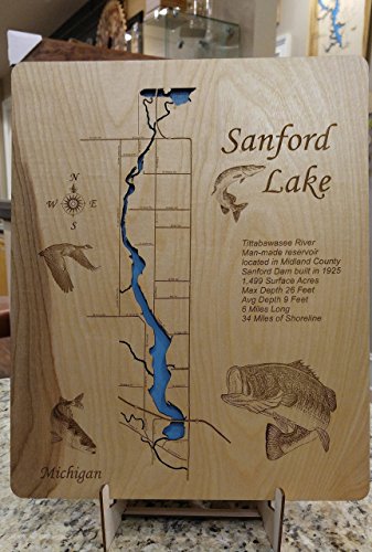
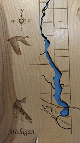

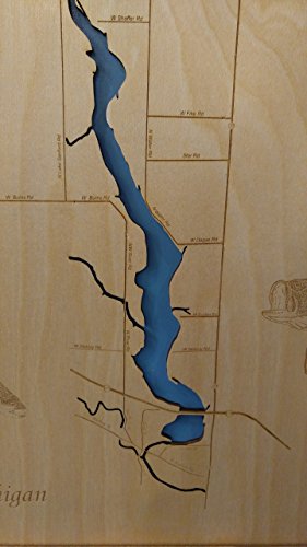
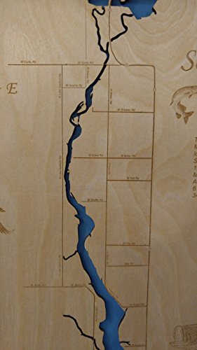

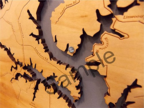
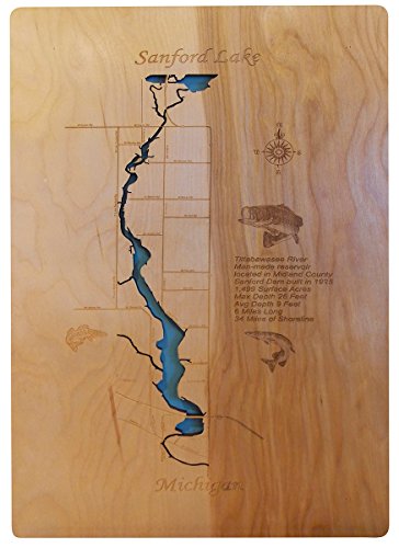
This is a beautifully detailed, laser engraved and precision cut topographical Map of Sanford Lake in Midland County, Michigan with the following interesting stats carved into it: Tittabawasee River, Manmade reservoir located in Midland County. Built in 1925,1,499 surface acres,Max. Depth: 26 feet, Avg. Depth: 9 feet, 6 miles long, 34 miles of shoreline This stand out map is mounted onto a tranquil blue background with a key hole cut on the back and is ready to hang. Available in three sizes. Interesting factoid: Sanford Lake is a man-made reservoir located in Midland County, Michigan. It was formed by the damming of the Tittabawassee River near the town of Sanford, Michigan. The dam is owned and operated by Boyce Hydro, LLC. (Not all of this information made it onto the map, we just love to read up on the lakes we design). All maps include special points of interest laser engraved into the map face and come with a beautiful blue self-adhesive Swarovski Crystal to mark your preferred location on the map (see sample picture). Each map is a beautiful artistic handcrafted work of art using the finest woods with special attention to every detail. Due to the natural variation in wood grain, each map will vary slightly in finish and color, some come to us all blonde and some has beautiful variances, making each one unique and one-of-a-kind. If you would prefer lighter or darker don't hesitate to ask. (Photo shown is our showroom display. Your map will be very close to this, but wood grain, knots, and final finish color may be slightly different.) Birch is our wood of preference. Once the map is cut and engraved we hand sand multiple times, assemble and clear coat them for a lustrous wood shine. We believe that this personal attention each and every item receives makes each wooden item a unique work of art. Made in the USA by American workers in an American owned business.
Trustpilot
3 weeks ago
1 month ago
