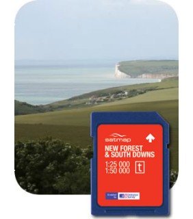
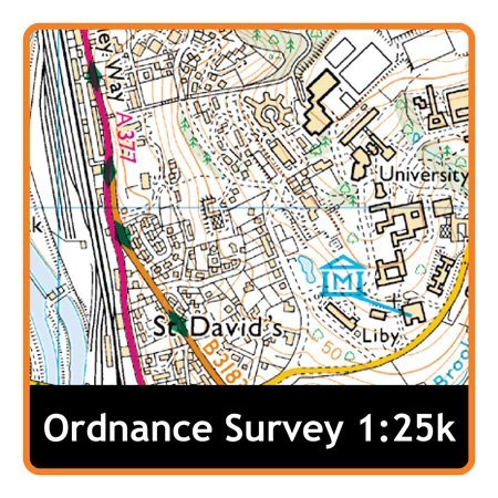
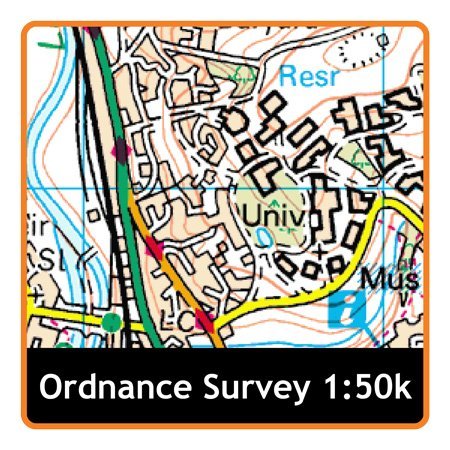
The New Forest was set aside as a hunting forest by William the Conquer more than 900 years ago, and is one of the largest lowland heaths remaining in Europe. This landscape of ancient woodland, picturesque villages and heather covered moors and heathland stretches down to the coast, and is fringed with salt marshes and mud flats. Close to the New Forest is the start of the chalk hills of the South Downs, stretching eastward for more than 90 miles to the spectacular white cliffs of Beachy Head. The Downs offer an exceptional variety of rare plant and wildlife species, thriving on the high chalk downland, the small fields and the deep wooded valleys of the Weald, all of which can be enjoyed from over 2,000 miles of well managed trails for walking and cycling. This map card contains: Topographical Ordnance Survey (OS) 1:25,000 Explorer of National Park Topographical Ordnance Survey (OS) 1:50,000 Landranger of National Parkÿ This SD MapCard is designed to work with the Satmap Active range of GPS sports mapping devices. The latest Active 12 is a large screen Sports Mapping GPS, which displays highly detailed topographic mapping. Whilst being easy to use for new users, it also has a host of advanced features valued by professionals. The Active 12 follows on from the award winning Active 10 range, but includes a range of exciting new features:NEW: Large, bright 3.5" Hi-Res screen (HVGA, twice the pixels of the Active 10) NEW: Bluetooth Smart (4.0) - for Heart Rate Monitor and bike Speed/Cadence sensor support. NEW: Barometric Altimeter, for accurate pressure and elevation dataActive 12 GPS units come with 1 year free access to Satmap Xpedition Premium (online mapping and planning tool).The Active 12 device is pre-loaded with the following mapping: GB 1:250,000 & 1:1 million OS road mapping
Trustpilot
1 month ago
1 week ago
