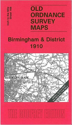
DESCRIPTION ADDED THANKS TO GENERATIONS GONE BY Here is information about Sheet 168: One Inch Sheet 168 Birmingham & District 1910 - published 2004; intro by Alan Godfrey. ISBN.978-1-84151-726-1 This One Inch to the Mile map is centred on Birmingham; part of the Black Country lies to the west, while eastward we find more rural Warwickshire. We have published a very good range of large scale, detailed maps for Birmingham and its environs, and this smaller scale map is an excellent companion to them, helping to put them into context. Coverage stretches from Halesowen and Rowley Regis eastward to Shustoke and Meriden, and from Sutton Coldfield southward to Solihull. On the back we include an extract from Warwickshire Sheet 19.03, showing the village of Olton in detail in 1903. It is not possible to list the many hamlets, farmsteads and other topographical features shown on these maps. However, you may find it useful if we list the towns and principal villages or church parishes that are included on this map. Links are given for those for which detailed large-scale maps are also available. Staffordshire: Darlaston, Great Barr, Oldbury, Rowley Regis, Smethwick, Wednesbury, West Bromwich. Warwickshire: Aston, Barston, Berkswell, Bickenhill, Birmingham, Castle Bromwich, Coleshill, Curdworth, Elmdon, Erdington, Great Packington, Hampton in Arden, Handsworth, Kingsbury, Lea Marston, Little Packington, Marston Green, Maxstoke, Meriden, Minworth, Nether Whitacre, Olton, Sheldon, Shustoke, Solihull, Sutton Co;ldfield, Water Orton, Wishaw. Worcestershire: Frankley, Halesowen, Hasbury, Illey, Kings Norton, Northfield, Yardley.
Trustpilot
1 week ago
1 day ago
