
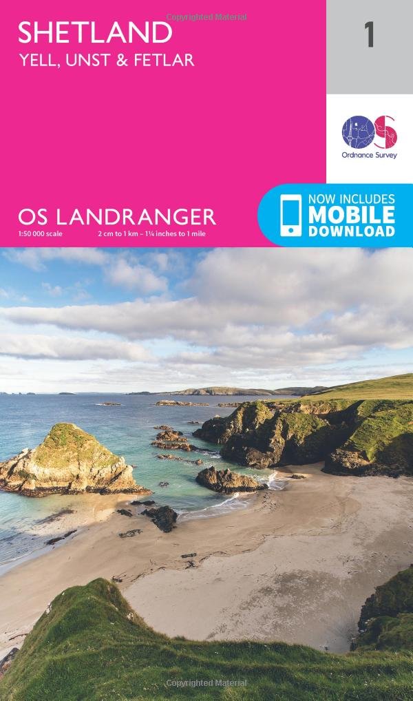


Shetland – Yell, Unst & Fetlar Map | Cullivoe & Mid Yell | Ordnance Survey | OS Landranger Map 1 | Scotland | Walks | Cycling | Days Out | Maps | Adventure
N**N
Five Stars
v good
S**D
Ottimo acquisto
Perfetta da portare in viaggio e con possibilità di scaricare le mappe sulla applicazione per cellulare.Utile e pratica
H**E
The north of Shetland...
The remote Shetland Islands north of Scotland feature an awesome landscape and a mixed Scandinavian-Scottish heritage. Ancient crofting survives alongside North Sea oil exploitation in a northern latitude with long summer days and long winter nights. This Ordnance Survey map covers the northern portion of the Shetland Islands, including the northern portion of Mainland, nearly all of Yell, Fetlar, and Unst. The scale is a very useful 1:50,000, generally adequate for navigation by automobile, bike or on foot.The map has a decent level of detail, good enough to tourist if paired with a decent guide book that explains the mixture of ancient and modern sites. The map comes with a link to a downloadable digital version, in case this folding paper version is a bit unwieldy in a breeze or becomes a casualty of the rather variable weather. Highly recommended for the enterprising traveler.
Trustpilot
1 week ago
2 weeks ago