


Big Basin, Santa Cruz Map (National Geographic Trails Illustrated Map, 816)
L**Y
Love National Geographic
These are great sturdy maps. National Geographic does a great job with the layout.
F**D
The Best Hiking Map for the Southern Santa Cruz Mountains
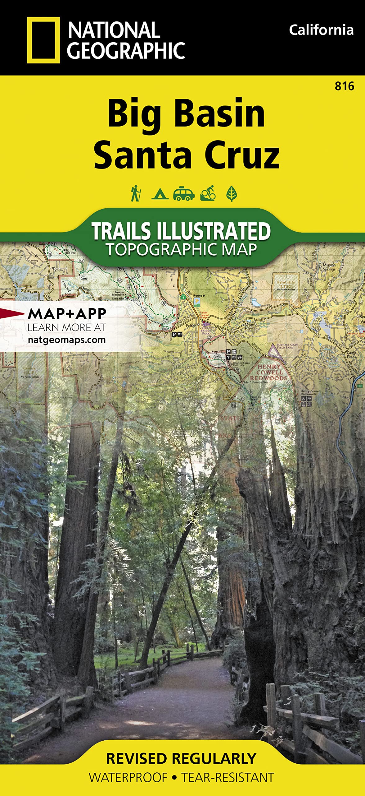
Maps in the National Geographic's "Trail's Illustrated" series are usually among the best available for hikers. This one is no exception. Clear and easy to read, it's scale is broad enough that you can follow nearly any trail among the many great parks in the area and at the same time locate yourself relative to any of the other recreational areas nearby. Several trail systems connect, and the map also shows the full Skyline to the Sea Trail, the pre eminent hike in the Bay Area. Of course, it features point to mileage for all trails and other recreational routes, is GPS compatible, and includes more hikes than the title implies. Besides Big Basin and Santa Cruz proper, Butano Creek, Henry Cowell Redwoods, Castle Rock, Ano Nuevo Preserve, and Sanborn Skyline Park are among the many great places you can hike using this map. The map does not, however, cover the northern end of the range. Still, this is a wonderful place to explore. I was pleased to see it included the public lands around Lexington Reservoir, and I will be visiting there on my next trip to the Bay Area. Highly recommended for dedicated hikers.
P**B
Only paper trail map of the area I could find!
My teen packs this map into his bag, for added assurance he won’t get lost when mountain biking. He used it to map out a dirt trail to Mt. Umunum and the visual gave us a contextual perspective that phone maps simply can’t reproduce. I could not find trail specific paper maps of this area anywhere, not at the ranger stations, not at AAA, not at bookstores. Yes, we have trail apps, Google maps, etc, but having a huge and detailed paper copy of trails in this area is very helpful and gives us peace of mind should the phone battery die.
R**S
Good map
Good map. With the recent fire in the park the map maybe dated
M**L
If there were one thing I would change about these ...
If there were one thing I would change about these National Geographic maps it would be to either have the key on both sides or flip one map over on the page so that you can flip over the fold with the key on it while looking at the opposite page and have it be right side up. While I can read upside down it's not ideal. Both sides are printed with north pointing to the same edge of the sheet, so if you turn over the key from the other side it is upside down. Otherwise it's a decent map for finding trails and getting a rough idea of land access possibilities.
D**S
I will survive
I got this map for my emergency bag in case there is a zombie apocalypse, or less exciting catastrophe. You never know when you're gonna be stuck in the woods trying to figure out how to get to a friends property without using the roads! Ha!
B**T
Great map
Best hiking map so far of the Santa Cruz Mountains. As always, a number of the roads depicted no longer exist but if you hike in the Santa Cruz Mtns, this is a must-have....
G**T
Five Stars
Excellent as always.
Trustpilot
3 weeks ago
3 days ago